
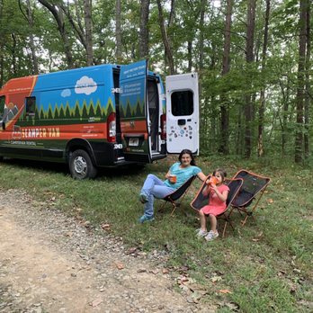
Amicalola Falls and the Appalachian Trail: An RV Base Camp Worth Knowing
Most people know Amicalola Falls as a day trip. Drive up, walk to the falls, take photos, drive home. That's fine. But if you've never used it as a base camp for a few nights, you're leaving the best part on the table.
Amicalola Falls State Park is the official approach to the southern terminus of the Appalachian Trail. The AT starts (or ends, depending on your direction) at Springer Mountain, 8.5 miles from the park's visitor center. The park itself has a 729-foot waterfall — the tallest cascading waterfall east of the Mississippi — and some of the best mountain camping in Georgia.
Getting There
The park is located near Dawsonville, about 65 miles north of Atlanta.
From our Cumming location: Take GA-400 North to GA-53 West. About 45 minutes. This is the closest Scamper location to Amicalola.
From our McDonough location: Take I-75 North to I-575 North to GA-53 West. About 80 minutes.
The road into the park has some grades and curves but is manageable in a Class C motorhome or travel trailer. Take it slow on the descent.
Camping at Amicalola Falls
The park has two camping areas: Len Foote Hike Inn (hike-in only, 5 miles) and the main campground with RV-accessible sites.
RV sites have 30-amp electrical hookups. The campground is well-maintained and sits in a wooded setting with good shade. Book through Georgia State Parks — weekends from April through October fill up fast.
The park also has a lodge if you want to mix RV nights with a night indoors, though most people stick to the campground once they're set up.
The Waterfall
The falls are a 0.6-mile walk from the visitor center on a paved path. The upper observation deck gives you the full 729-foot view. The base of the falls requires a steeper descent but puts you right at the water.
Go early morning or late afternoon to avoid the midday crowds and get better light for photos.
The Appalachian Trail Approach
The Approach Trail from the visitor center to Springer Mountain is 8.5 miles one-way with about 3,000 feet of elevation gain. It's a serious day hike — start early, bring plenty of water, and turn around if you're not making good time.
Springer Mountain itself is a flat, forested summit with a bronze plaque marking the southern terminus of the AT. The views are limited, but the significance is real. Standing at the start of a 2,190-mile trail puts things in perspective.
For a shorter taste of the AT, you can drive to the Springer Mountain trailhead via Forest Service roads and hike just the last mile to the summit.
What Else Is Nearby
Dahlonega is 20 minutes east and worth a half-day. It's a historic gold rush town with a walkable square, good restaurants, and several wineries on the surrounding roads. Kaya Vineyard and Wolf Mountain Winery are both within 15 minutes of town.
Chestatee Wildlife Preserve is a small but worthwhile stop, especially if you have kids. About 20 minutes from the park.
Vogel State Park is 45 minutes north and has its own excellent hiking, including the 13-mile Bear Hair Gap loop.
Practical Notes
- Dump station is available at the park.
- Cell service is spotty. Download offline maps.
- The park store has firewood, ice, and basics.
- Leashed pets allowed on most trails.
- Fall weekends are the most competitive for campsites — book 6–8 weeks out.
Three nights here is the right amount. One day for the falls and the lower trails, one day for the Springer Mountain hike, one day to do nothing and sit by the campfire.
Check fleet availability [blocked] for your dates. Contact us [blocked] if you have questions about which unit is right for this trip.